
Description
Octopus PSIM mobile application can be installed on android based units with GPS sensors, which can be used by first responders with mobile phones or fixed on security vehicles, in order to track the first responders, security patrols, company fleet trucks & vehicles in real time on the PSIM GIS map. When an incident occurs, the PSIM system can locate and dispatch the nearest first responder who is closest to the incident.
The Octopus PSIM and mobile application platform also enables setting up pre-defined Patrol Routes or logistical routes for company delivery/logistics fleet. The Octopus Patrol Management System enables the command center to define routes and check points for the vehicles/ on-foot security officers via the PSIM system GIS map. These patrol routes are sent to the security vehicle mobile application terminal for their daily patrol route check points. Different predefined routes can be sent to the security vehicles/officers each day.
The security officers receive the routes and associated tasks per each check point on their mobile terminal running the Octopus application. Routes are received including navigation directions. When selecting the route, the application opens the navigation software which gives navigation instructions for each check point. System allows creating QR codes that can be fixed on locations and upon reaching the checkpoint, security officers scan the check point’s QR code with his application smartphone camera. System checks that the security vehicle/officer is within the geo location of the check point. The scan updates the command center route log and the security officer can receive check point related tasks, if there are any.
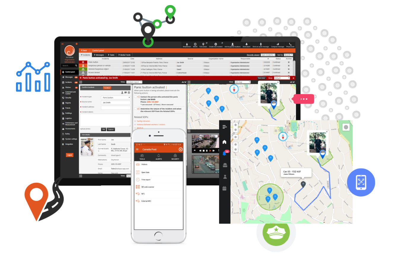
Command center can track Security vehicle/officer location at any time via the command center GIS map. Command center can negotiate a 2 way communication with the guard, including text and voice over IP. Geo fencing and route based rules can be set in order to keep security vehicles to the set routes or to certain general areas and to not stray from the mission. Notifications can be received in case of detouring. This applies to logistical routes as well. System records all the driving routes and can display the history route for data interrogation. The Octopus mobile application offers additional modules for security officers such as incident fill-out and reporting, including adding photo to the incident report. Incidents are saved on PSIM server or can be interfaced to security incident system.
Route optimization and predictive route tasking:
- ♦ Octopus Safe City integrates with the crime database and receives all the daily events:
♦ Police crime data sources
♦ OSINT – Open source intelligence - ♦ Octopus BI and Machine learning system receives, analyzes and prioritizes the crime incidents at the end of each day and allows display on GIS map
- ♦ Octopus system generates daily preventive police routes according to crime prioritization
- ♦ Police field units receive each morning automatically their daily patrol routes and tasks on their mobile device
- ♦ Octopus system monitors the police units to make sure they are following their routes, posts and tasks
- ♦ System presents abnormalities and staff which are not at their location or following their work tasks
- ♦ Police command can dispatch police units to incident location at any given time.
Town protection project. Integration to: Radars, seismic sensors, surveillance cameras, intrusion alarm, and alarm receiver. Cameras track targets detected by radars and seismic sensors.
Reviews
There are no reviews yet.